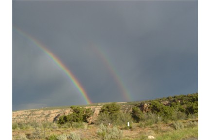
Glade Park and Pinon Mesa
Quick Facts

Glade Park ZIP Code Map
Glade Park: Mesa County Land Use and Development Plan #31
Although this plan was adopted on 12/22/88, it is still the current plan on record. It does not seem as outdated as one would think, in these fast changing times. The basic concerns are still pretty much the same. That is good news to those of us who have moved here because we like it pretty much the way it is. Unfortunately improvements can bring other changes that are not so welcome.
One change we do approve of because growth seems inevitable: the Glade Park Volunteer Fire Department HAS continued to upgrade their services, including EMT. That is a tough job without any government funding and in addition to providing vital services they put a lot of effort into fund raising (Residents who aren't making a yearly donation should be.)
Glade Park Demographics & Community Profiles
Take them with a grain of salt. Outdated and extrapolated information, and applying a template designed for cities, makes for some questionable results.
"Mixed Company" WMD test: Nov. , 1972
Don't let this scare you. We are a nice community that just happens to have had some "mixed company." BADDA BING, BADA BOOM, BADDA BANG!
The Water Link Between Pinon Mesa and Fruita -
This article from the Grand Junction Daily Sentinel by local historian Kathy Jordan tell the story of how the Fruita's search for a clean water supply created a lasting link between Pinon Mesa/Glade Park and Fruita, CO.
Glade Park & Pinon Mesa
Geography and Natural Description
Physical description: The Glade Park/Pinon Mesa area is located where the the north western end of the Uncompahgre Plateau has been severed into a separate land mass by Unaweep Canyon. It begins in Colorado, and continues on into eastern Utah.
Elevations:4100 to 9671 on Pinon Mesa.
Pinon Mesa runs along the North edge of Unaweep Canyon, and on the west end, along the Delores River canyon. Gamble's oak increases with elevation, along with Englemann spruce, and subalpine fir, and aspen. Along the lower rivers and streams, cottonwoods and willows fight for space with invasive tamerisk.
A sheepherder/naturalist describes Pinon Mesa: The Year On Pinon Mesa
As the name implies, Glade Park is the lower, flatter, open park that is dominated by sagebrush, pinon pine, and Utah juniper. On the west end, the park looses elevation, and is bordered on the north by sandstone cliffs.
Glade Park and Pinon Mesa Geology
"Geologically, the area is a remnant of an ancient highland know as Uncompahria, a part of the ancestral Rocky Mountains which were uplifted 300 million years ago. During the Pennsylvania period, when the rest of Colorado was under an inland sea, Umcompahgria was an island. Erosion during the Pennsylvania period removed all the rock layers above the Precambrian metamprohic rock. By the end of the Permian, the landscape was nearly a level plain. The Precambrian rock was again buried by sediments during the Triassic and Jurassic Periods, leaving an unconformity representing over 300 million years, or the entire Paleozoic sequence, between the Precambrian and Triassic. The Mesozoic sediments can be seen now as the Cutler, Moenkopi, Chinle, Kayenta and Wingate sandstones of the Triassic, and the Entrada and Morrison formations of the Jurassic. Over these layers were deposited the Dakota and Mancos formations of the Cretaceous period. The Plateau was again uplifted later in the Cretaceous period, along with the Rocky Mountains during the Laramide Orogeny, thus beginning a new period of erosion which continues today. The last major uplift occurred during the Miocene, when the entire Colorado Plateau was elevated ( Chronic 1980, Collins 1985).
At present, the Mancos shale has almost completly eroded from the top of the plateau, but can be seen on the surrounding lower mesas. Along the eastern slope, and on the Black Ridge, the more resistent cap of Dakota sandstone (Cretaceous) has survived. The Jurassic and Triassic layers which dominate the plateau today are mostly horizontal. On the sides of the plateau, deep canyons have cut into the sandstone layers, exposing the colorful canyon walls of the area. In deeper canyons such as Unaweep and along Little Delores River, Precambrian granites have been exposed (Chronic 1980, Collins 1985)." ---Natural Heritage Resources of the Glade Park-Pinon Mesa Area, Mesa County, Colorado and Grand County, Utah, Prepared for the Nature Conservancy's Colorado Field Office. March 1996


